
WATER QUALITY
As India’s water quality crisis deepens, it is necessary to map water quality and provide relief to the affected areas providing stable freshwater is the most pressing of the many environmental challenges on India’s national horizon. Multiple influence peddlers like population explosion, rapid urbanization, industrialization and agricultural development are putting stress on water resources. This has resulted in high impact on quality and quantity of water in the country. Summer and rainy seasons witness the eruption of water-borne diseases, such as, cholera, gastroenteritis and diarrhea due to poor quality of drinking water and sanitation.
Looking at the seriousness of the issue, government authorities sought to map the water quality in rural regions and take counter-measures to provide relief to affected areas of respective states.
Aim was also to identify the contaminated surface sources. It intended at obtaining valid, reliable and credible data of water quality as a whole and in further course, the corrective measures to ensure safe and quality water supply to rural India.
Location – India
Client
ADCC Infocad Pvt Ltd
Our Services
– Water quality test
– Assest Mapping
– GIS field survey.
Developing Decision Support System through Web GIS application intended data retrieval and MIS analysis for the authorities. Mapping and unique identification as well as transportation planning using GIS-based customized real time monitoring tools eased down the time-bound water analysis and data management for numerous samples.
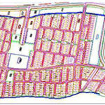
The mapping activity took place in Autodesk Map software, similarly data integration in ArcGIS software to produce thematic maps. GPS mapping 2,200,000 sources (and counting) for Uttar Pradesh. Unique id-based sources were snapped and recorded geographically in the latitude-longitude format using GPS handhelds along with asset mapping. The DSS development took place using Open Source Spatial Server.
GIS integration helped in understanding the location-based details of water contamination. Water quality maps prepared in GIS, together with sanitation data, assisted in understanding the priority area for water treatment and drinking water quality monitoring for the future. These maps also aided in identifying certain contaminated locations immediately and actions to be taken by the department officials. We facilitated Water Quality Management (WQM), sanitation data updated and digital photo collection using GPS-based applications.